Korouoma Canyon Frozen Waterfalls
Orientation Guide

Korouoma Canyon Frozen Waterfalls Map

Korouoma is a 30-kilometre fracture valley cutting through the forests of Posio, and its winter reputation rests on a cluster of ice falls hanging from the canyon's south-facing walls. Reading the terrain correctly matters more here than in most Lapland destinations, because the trailheads are far apart and the frozen falls are not evenly distributed. This page explains how the canyon is laid out and what the route markings actually tell you.

9 min read Updated 2026-08-13 Fact-checked
Korouoma Canyon Frozen Waterfalls Map

Quick answer

The main frozen waterfalls sit along the canyon's western section, reached from the Saukkovaara trailhead at Saukkovaarantie, 97815 Posio. Entry to the nature reserve is free, and the area is open around the clock. In practice, winter daylight is the real constraint: arriving between 08:00 and 14:00 leaves enough light to reach the ice falls and return safely.

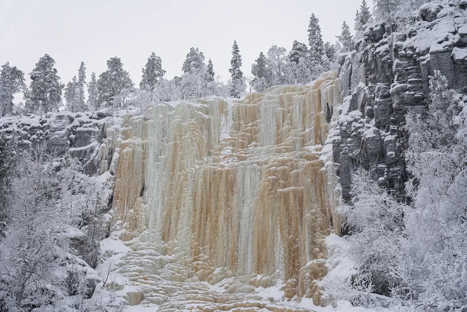
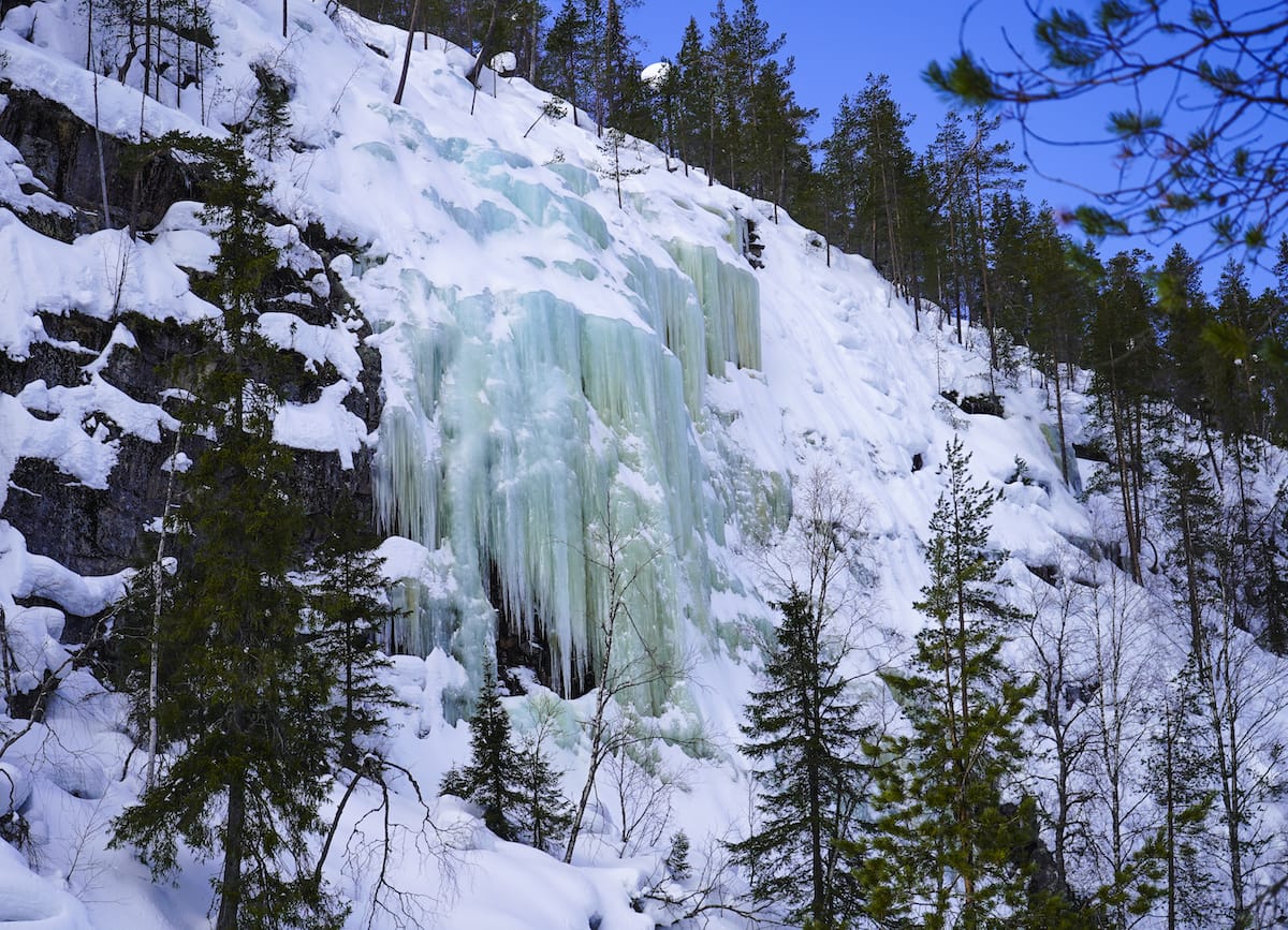
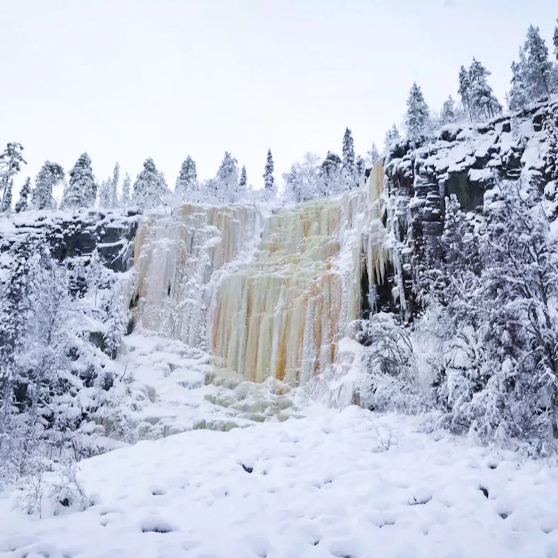
Korouoma was not carved by a river. The canyon is a fracture zone in the bedrock, torn open along a fault line that geologists date to roughly two billion years ago, and the stream running through it merely occupies a valley that was already there. That origin explains the walls: near-vertical rock faces up to 130 metres high, seeping groundwater year-round. In winter that seepage freezes in place, producing the columns of blue and ochre ice that give the canyon its cold-season fame. A korouoma canyon frozen waterfalls map is therefore less a list of attractions than a reading of where water meets rock face. Visitors arriving without orientation often misjudge the scale. The reserve covers a long ribbon of terrain in Posio, Finnish Lapland, and several marked routes enter it from different directions — the Koivuköngäs approach, the Piippukallio ridge and the descent from Saukkovaara among them. Not every entry point leads to ice. The frozen falls cluster on shaded aspects where sun exposure stays minimal, and the standard winter route links them in sequence rather than looping past all of them at once. The Metsähallitus signage on site uses the same colour coding as the official Luontoon.fi trail sheets, so a printed jäätyneet vesiputoukset kartta downloaded in advance will match what is nailed to the posts in the forest. The practical use of a korouoma canyon frozen waterfalls map is judging distance against daylight rather than choosing between attractions. Snow depth alters walking pace considerably; a route that reads as straightforward on paper behaves differently under half a metre of powder, and the descent into the canyon involves steps and duckboard sections that ice over. Cross-country skiers and snowshoers use partly different lines through the valley floor. Anyone consulting a Korouoma Canyon frozen waterfalls map guide should treat the marked kilometres as a minimum and check current trail condition notices before committing to a longer variant. The reserve belongs to a wider network of Lapland nature reserves managed for low-impact visits, which means no lighting, no facilities beyond wilderness huts and fire rings, and no one clearing the path ahead of you.

“Korouoma was not carved by a river — it is a fracture in bedrock, and the ice simply follows the seams.”
Itinerary

Korouoma Canyon Frozen Waterfalls Map and Visit Plan

This plan suits reasonably fit walkers doing the Korouoma frozen waterfalls loop from the Koivuköngäs trailhead in a single day, with roughly 5 to 6 hours from parking back to parking. Distance is about 11 kilometres on marked trail with a steep descent into the canyon and a climb back out.

09:00

Start at Koivuköngäs trailhead

Read the trail map board at the parking area and confirm the marked route before setting off. Allow 10 minutes here, and note the return junction sign so you recognise it later.

09:20

Descend into the canyon

Follow the marked path down the canyon wall, losing around 100 metres of elevation over duckboards and stairs. Budget 30 to 40 minutes and take the descent slowly, as this is the steepest part of the day.

10:00

Reach the canyon floor

Cross the streambed area at the base and pick up the valley trail heading toward the ice falls. The ground here is uneven, so expect a slower walking pace than on the upper path.

10:40

Jaska Jokunen ice wall

The first large frozen fall sits directly beside the trail; most people spend 20 to 30 minutes here. Keep clear of the base, where ice fragments fall.

11:30

Mammuttiputous and neighbouring falls

Continue along the canyon to the tallest of the frozen falls and the smaller curtains around it. This is the natural turnaround point and the best place for a break.

12:30

Lunch stop at the lean-to

Use the laavu shelter and fire ring near the falls for a warm break of 30 to 45 minutes. Firewood is provided but not guaranteed, so bring a thermos as backup.

13:15

Return climb to the rim

Retrace the valley trail and take the marked ascent back to the plateau, which is the hardest hour of the loop. Pace yourself and drink before starting the climb.

14:30

Finish at the parking area

Close the loop on the level forest track back to the trailhead. Arriving by mid-afternoon leaves margin before the light goes in midwinter.

Timing

Best Time to Visit Korouoma Canyon Frozen Waterfalls

The optimal window to observe frozen waterfalls in Korouoma Canyon is between January and March, when temperatures consistently remain below freezing to support ice formation. Visiting during the early daylight hours ensures maximum visibility for navigating the trail system.

January–March

Low to moderate

Below -10°C; icy conditions

This peak season offers the most reliable ice formations on the canyon walls.

Weekday mornings

Minimal

Arriving early helps avoid weekend hikers and provides ample daylight for the descent.

April

Increasing

Thawing ice; near 0°C

Rising temperatures cause ice to melt, making trail conditions unstable and potentially dangerous.

Verdict: January to March, arriving between 08:00–14:00, provides the safest conditions and best views of the frozen waterfalls.

Directions

How to Navigate to the Korouoma Canyon Frozen Waterfalls Map Location

Korouoma Canyon is located in the Posio municipality of Finnish Lapland. Reaching the trailheads typically requires a private vehicle or a pre-arranged guided transport service, as public transit options to the canyon are limited.

Car Varies by origin

Drive to Saukkovaarantie, 97815 Posio, Finland

Taxi Approx. 90-120 min

Private transfer from Rovaniemi

The primary trailhead address is Saukkovaarantie, 97815 Posio, Finland. Plan your arrival for the 08:00–14:00 window to ensure adequate daylight for your excursion.

What to see

Notable Frozen Waterfalls on the Korouoma Canyon Map

The Korouoma Canyon trail features several prominent frozen waterfalls that serve as key landmarks for navigation. Identifying these formations helps visitors track their progress along the canyon floor.

Ruskeavirta

Ruskeavirta

Located in the northern part of the canyon, this formation is known for its distinct brownish color caused by iron-rich water. It is one of the first major sights for those descending into the valley.

View from the base to see color variations in ice.
Jupukanputous

Jupukanputous

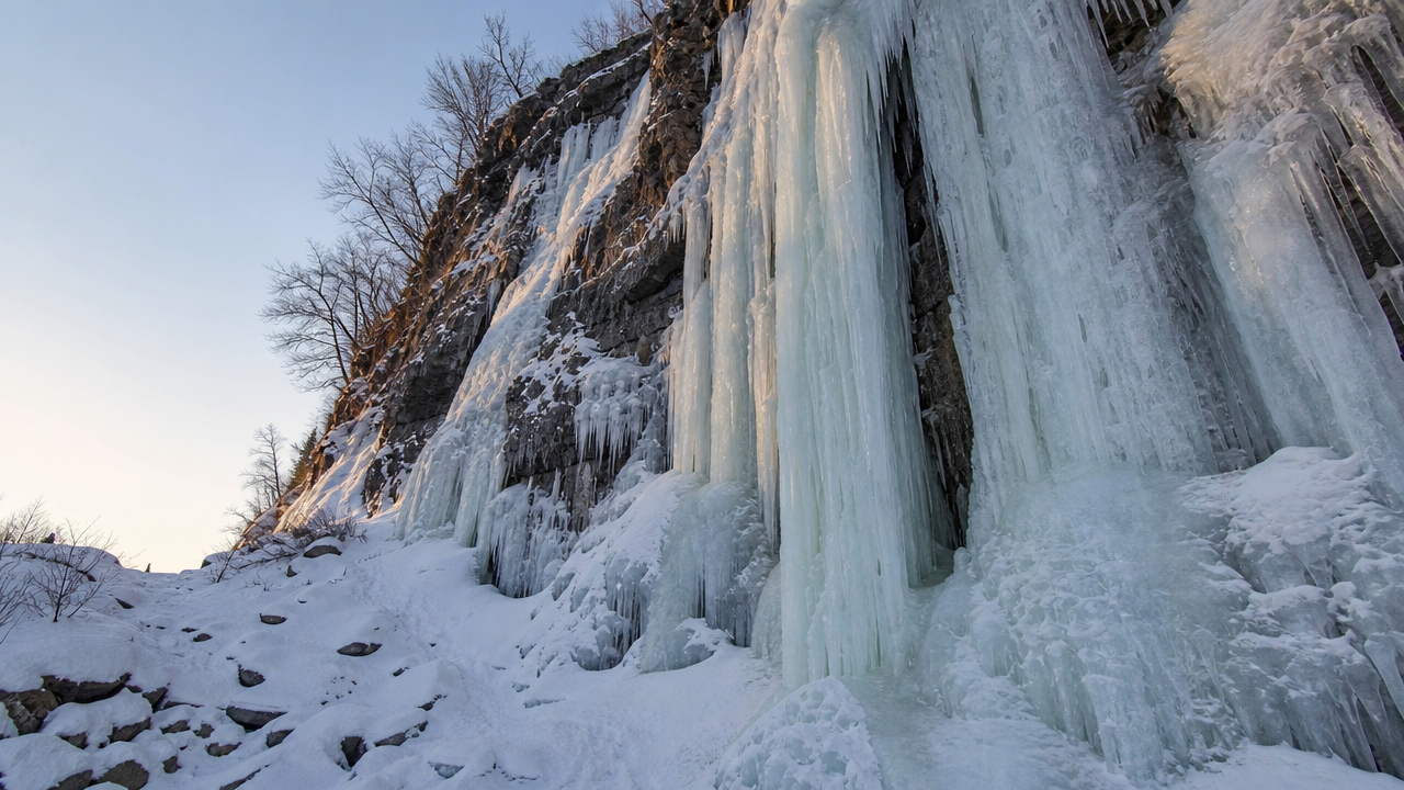
This waterfall is situated along the main hiking path and often features large, thick ice columns. Its position makes it a frequent stop for photographers assessing ice structure.

Observe the vertical ice pillars from the marked trail.

Mammuttiputous

Mammuttiputous

Often referred to as the Mammoth Fall, this is one of the largest and most impressive ice walls in the canyon. It stands out due to its massive scale compared to surrounding formations.

Walk to the central viewing area for full scale.

Opening hours

Operational Hours for Korouoma Canyon Frozen Waterfalls

The Korouoma Canyon nature reserve is accessible to visitors at all hours throughout the year. The area remains open daily to provide access for those hiking the frozen waterfall trails.

Monday
00:00–23:59
Tuesday
00:00–23:59
Wednesday
00:00–23:59
Thursday
00:00–23:59
Friday
00:00–23:59
Saturday
00:00–23:59
Sunday
00:00–23:59
There is no formal last-entry restriction as the nature reserve is open 24 hours a day.
Checklist

Essential Preparation for Your Korouoma Canyon Frozen Waterfalls Map Trek

Korouoma is a remote, unstaffed canyon where frozen waterfalls, steep descents and sub-zero conditions demand real preparation before you set off.

Book

Check availability

Frequently asked

Frequently asked questions about korouoma canyon frozen waterfalls map

Everything you need to know about korouoma canyon frozen waterfalls map

Where can I find a korouoma canyon frozen waterfalls map?

You can download a digital korouoma canyon frozen waterfalls map from the official Luontoon.fi website. Physical maps are also often available at local tourist information centers in Posio.

Is the korouoma canyon frozen waterfalls map necessary for hikers?

A detailed map is highly recommended because the terrain can be challenging during winter conditions. It helps you navigate safely between the various ice formations and marked hiking trails.

What is the best time to use a korouoma canyon frozen waterfalls map?

The best time to visit is during the winter months, specifically arriving between 08:00 and 14:00 to maximize daylight. Using the map during this window ensures you have enough visibility to enjoy the geological features.

Are there entrance fees for the nature reserve?

There is no cost to access the area as the entrance fee is 0 EUR. The nature reserve remains open for public use at no charge.

Is the Korouoma Canyon trail suitable for children?

The trail can be physically demanding, especially in winter, so parents should assess their children's hiking ability carefully. Always check trail conditions before departing to ensure the path is safe for your family.

Can I visit the Korouoma frozen cascades all year round?

While the nature reserve is open 24/7, the famous frozen icefalls are only visible during the colder months when temperatures remain below freezing. Outside of winter, the canyon serves as a scenic hiking destination for exploring the rift valley.

Keep reading

More guides & pages